| Home | Specifications | Modifications | Pictures | Trips | Logbook | Links |
 Southern Sicily and Sicily Strait Islands |
 |
| Click on a picture to get it magnified |
Malta
 Map of Malta |
 Prehistorical vestiges |
 Tipical houses |
 Prehistorical vestiges |
 Town gate of Mdina |
 Mdina |
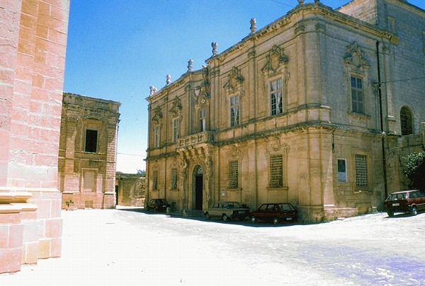 Mdina |
 View from Mdina to Valletta |
 View to the Mellieha bay |
 Beach at Mellieha bay |
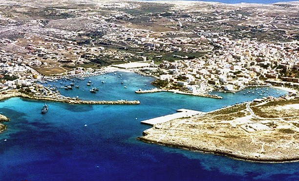
 Bay next to Marsaxlokk |
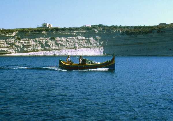 tipical maltese boat |
During
the ice age the Mediterranean area was not a sea but a number of lakes
with land bridges. Sicily was connected to the north of Africa and Malta
was a mountain along the land bridge. As the ice melted, the water level
raised, the street of Gibraltar opened to the Atlantic Ocean and the
land bridges were submerged. Malta became an island. In Malta there
can be found bones of elephants, bears, deer, hippopotamus, giant dormice,
huge tortoises, etc. The first settlers in Malta came from Sicily about
5000 B.C. They developed to a high culture and a lot of vestiges from
the stone age to the bronze age can be found on the island. About 700
B.C. the Malta islands were colonized by the phoenicians and about 300
B.C. by the Romans. During this time all trees on Malta were cut down
for buildings and ships. 870 A.D. came the Arabs, 1070 the Normans,
1530 the Knights of the crusades, 1798 the French and 1800 the British.
The various dominations left their imprint on this tiny island. The
maltese language is an interesting mixture of all the different cultures. The Malta islands situated in the middle of the mediterranean sea were and are still strategically very important. Malta offers also deep and good protected natural bays, especially Marsamxett harbor and Grand Harbor from where the british fleet controlled the mediterranean area during the WWII. Malta is now a republic and will become full EU member in 2003. The main revenues in Malta are coming from the Tourism and from the Shipyards in the Grand harbor. A cruising yacht has to announce itself before entering the Marsamxett harbor and to check in at the customs. In the last years there was a lot of liberalization regarding the cruising along the maltese waters. Situated in the middle of the Sicily channel, the waters around Malta are seldom very calm and strong winds are not rare. For more information see http://www.malta.com |
|||||
Lampedusa & Lampione Islands
 Map |
 nautical map |
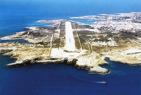 view of the airport |
|
|
|
| Lampedusa
is an almost plain limestone island emerging from the african continental
shell. Lampedusa was inhabited by Punic, Greek, Roman and Saracens and
in modern times first resettled in 1800 by Maltese and later by Sicilians.
The whole population of Lampedusa counts now about 5500 people and belongs
to Italy. The coast and waters around the island are very beautiful, especially around the isola dei conigli where every year sea turtles (carretta carretta) lay eggs. There are a lot of good bays for anchoring and the harbor is good protected against all winds. Only strong southerly winds can form a huge swell in the outer harbor. For more information look at: http://www.lampedusa.it, http://www.lampedusa.to Some information for navigation in Italian: avvisi e consigli |
|||||


Linosa Island
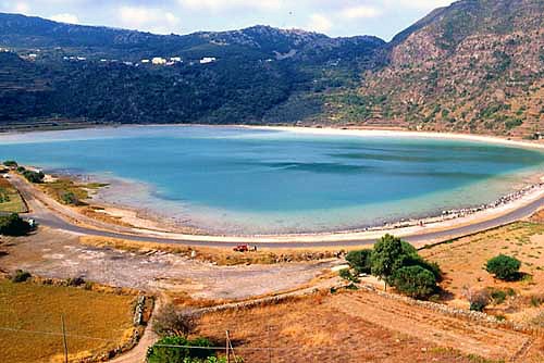
 Map |
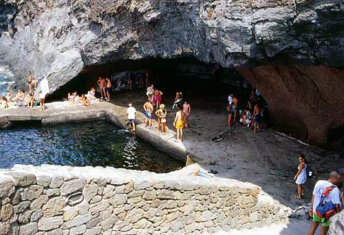
 Cala Pozzolana |
 The harbor next to the village |
 The village |
 The village |
 The village |
 view of the coast |
 view of the coast |
Linosa
is a volcanic island placed over the same tectonic rift between Africa
an Sicily as Pantelleria. About the history of Linosa it is only known,
that she was inhabited during Roman times and later used by pirates.
Like Lampedusa, Linosa was resettled by Sicilians from 1800 on but long
time forgotten by the belonging governments. The actual population of
Linosa is of about 480 people. A lovely island!!! Anchoring and fastening to the peers at cala Pozzolana and in the harbor next to the village are possible only at calm weather conditions. Some information for navigation in Italian: avvisi e consigli |
|||
Pantelleria Island
 Map |
|
|
|
|
|
 view of the coast |
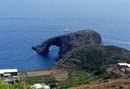 scoglio dell'elefante |
 view of the coast |
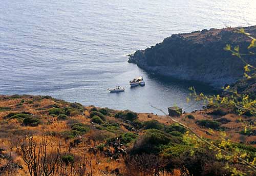 view of the coast |
 view of the coast |
 view |
 dammusi, typical pantescan houses |
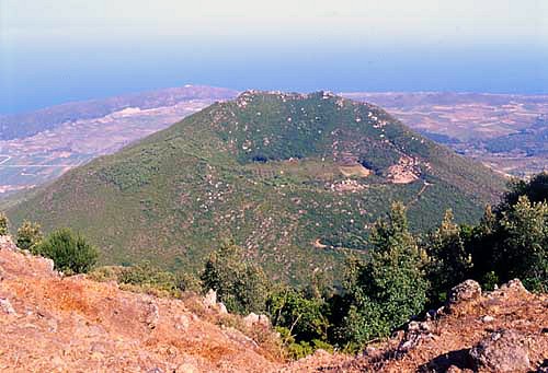 an extinct volcano |
 view |
 thermal sources |
 a capers plant |
 Scari |
Pantelleria
is situated along the tectonic rift between Africa and Sicily and is
an island with clear volcanic origins and there are still many volcanic
manifestations present on the island. The first settlings on Pantelleria were about 6000 BC. The main economic factor was Obsidian, used for all cutting tools followed by farming and stock-breeding. About 1800 BC most of the island was occupied by groups of farmers coming from Sicily. Sometime during the 9th century BC the island became part of the Phoenician trade network from Lebanon to the Atlantic. Pantelleria's first name was Yrnm, and later was changed into Cossyra. After the Phoenicians and Carthage, Pantelleria was conquered by the Romans 248 BC. The Arabs captured the island from Byzantium around 750 AD and introduced the cultivation of cotton, for many centuries the major export of the island. The arabs called the island al-Quasayra or Bint-al Rion, "daughter of the wind". The political control of the Arabs ended with the Norman conquest at the end of the 1100. Pantelleria was still peopled by muslims. 1492 all muslims were expelled from the island and the island was resettled with Spaniards, Portugueses and Italians. In 1860 Pantelleria was annexed, together with Sicily, to the Kingdom of Italy and has shared its historical vicissitudes up until the present. During the WWII Pantelleria, heavily suffered from strong air strikes by the Allies over the fortresses of the fascistic regime. Tourism, capers and grapes are the economic backbones of Pantelleria. The main, and sole secure harbor is in the NE corner of the island. A few peers for yachts were constructed recently and a project to rise the reception capacity has been approved. Around Pantelleria are only few anchoring sites and commonly deep waters. More information about Pantelleria at: http://www.pantelleria.it |
|||||


Home Specifications Modifications Pictures Trips Logbook Links e-mail